
← All communities

Dirt Road Real Estate
Life Begins Where the Pavement Ends · (928) 897-1364 · dirtroadrealestate.com

Area guide · Mohave County, Arizona

Land & Homes for Sale in Hackberry, AZ

Life Begins Where the Pavement Ends

A small Route 66 community northeast of Kingman.

At a glance

Elevation
4,023 ft (town center)[1]
School district
Hackberry School District (part of the area is in Valentine Elementary School District)[1]
County
Mohave County

Driving distances

Approximate, town center to town center, by OpenStreetMap routing[2]. Times vary with road and weather.

Rural essentials

Water

  • Confirm the water source for each parcel.

Power & solar

  • Mohave Electric Cooperative lists Hackberry among the communities it serves.[4]
  • Off-grid solar is common on rural parcels here; size a system to the property and confirm any utility line-extension costs with the provider.

Septic & building permits

  • Mohave County Development Services handles septic (on-site wastewater) permits under authority delegated by ADEQ. The county requires an approved septic system for any building project with plumbing. The usual order is a site investigation, then the septic application and a Construction Authorization, then inspection and a Discharge Authorization before use. A licensed installer often handles the permit.[8]

Internet

  • Internet options vary by parcel. Check the FCC National Broadband Map (broadbandmap.fcc.gov) for the providers reported at a specific address; satellite service is common on rural parcels.[16]

Hospital

  • Kingman Regional Medical Center, 3269 Stockton Hill Rd, Kingman.[13]

Outdoors

  • Historic Route 66 passes through Hackberry.

Current listings in Hackberry

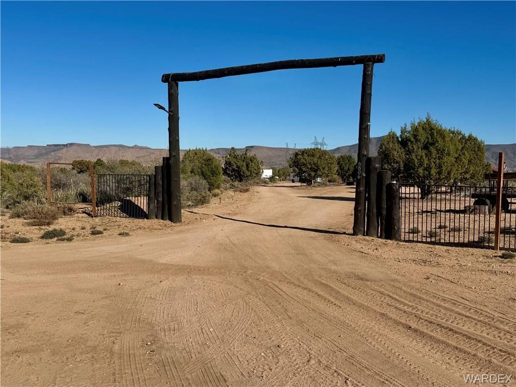
40.83 acres in Hackberry, 6806 N Frerichs Ranch Road, Hackberry, AZ 86411Active · Land
$174,000

40.83 acres in Hackberry

6806 N Frerichs Ranch Road, Hackberry, AZ 86411 · MLS #036821
40.83 acres

Just over 40 acres in Spring Valley Ranches, nestled on the backside of the Peacock mountains, overlooking the Music mountains and Cottonwood range.

Sources

  1. Wikipedia town article (elevation from infobox; school district per 2020 U.S. Census school district reference map)
  2. Driving distance/time: OpenStreetMap routing (OSRM), town center to town center, retrieved Oct 29, 2026
  3. Mohave Electric Cooperative, mohaveelectric.com/about-us/our-cooperative
  4. Mohave County Development Services, Septic & Well Permitting and Residential Building pages, mohave.gov
  5. Kingman Regional Medical Center, azkrmc.com
  6. FCC National Broadband Map, broadbandmap.fcc.gov

Area information is general and was checked against the sources above on Oct 29, 2026. Verify water, power, access, zoning and permits for any specific parcel. Equal Housing Opportunity.